canopy Footprint (Absolute)
Algorithm details: Technical Guide → Canopy Footprint (Absolute)
What does this tool do?
Canopy Footprint (Absolute) generates footprint polygons for each input line using an absolute threshold method. This is useful for mapping the area around lines (like roads or rivers) based on a canopy or cost raster, with user-defined thresholds.
How do I use it?
Quick Start
- Prepare your input files: a centerline vector file (GeoPackage or Shapefile) and a CHM raster file.
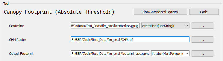
- Run the tool from GUI:
What options can I set?
- Centerline: Path to your centerline line file
- CHM Raster: Path to your CHM raster file
- Simplify Footprint Polygon: Optionally simplify output footprint polygons after raster-to-polygon conversion
- Footprint Simplify Length (m): Simplification tolerance for footprint polygons
- Smooth Footprint Polygon: Optionally smooth output footprint polygon boundaries
- Footprint Smooth Iterations: Number of polygon smoothing iterations
- Output Footprint: Path for the output footprint file
Tips
- Works best with line data and a canopy or cost raster.
- Adjust
corridor_threshandmax_ln_widthfor your data and mapping needs. - Raster generalization removes small mask artifacts; footprint polygon simplify/smooth controls improve vector boundary shape after polygon extraction.